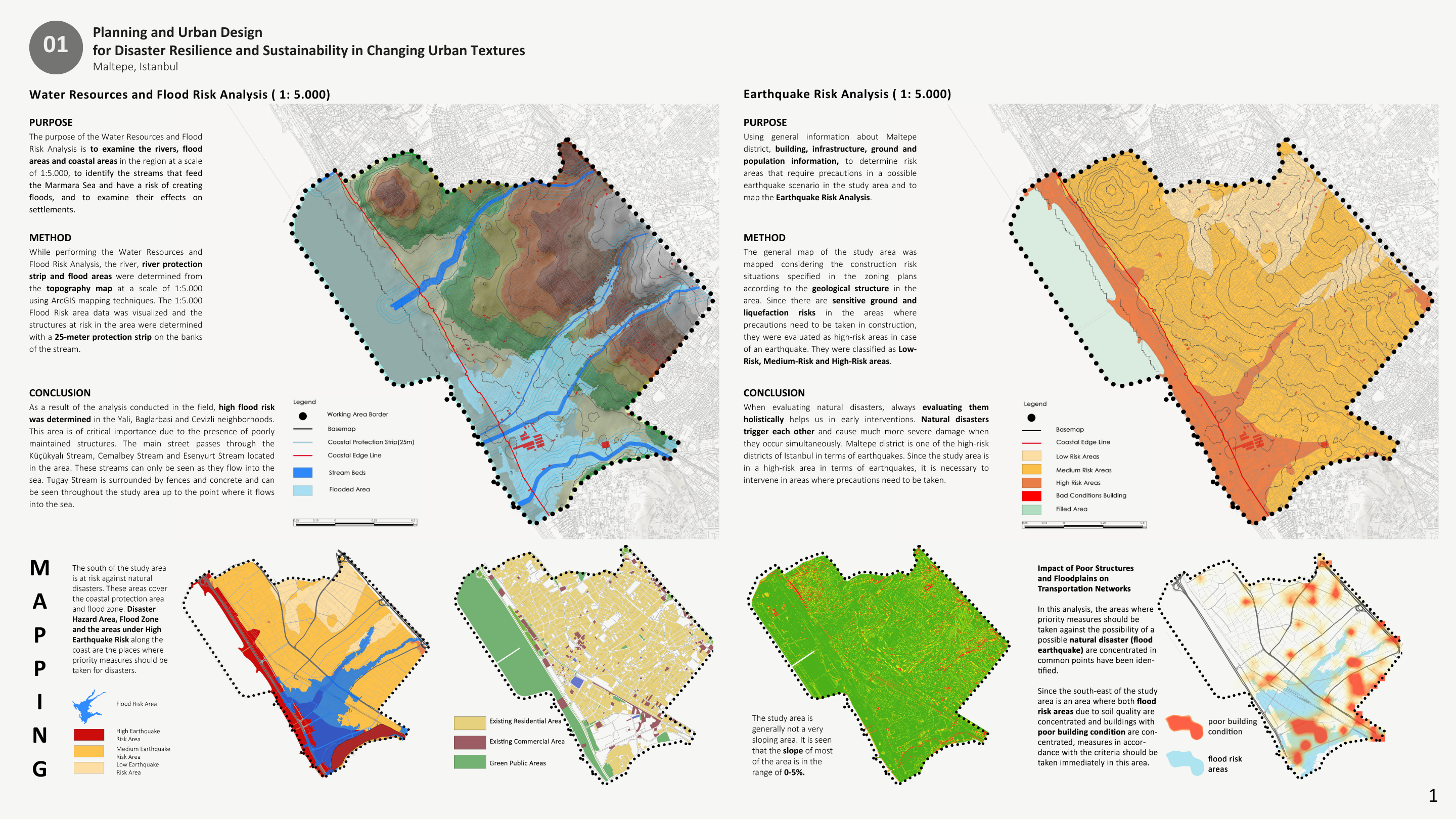
• Water Resources & Flood Risk Analysis – Earthquake Risk Analysis (1:5.000)
This study analyzes flood and earthquake risks in Maltepe, Istanbul at a 1:5,000 scale by integrating water resources, geological structure, building conditions, and urban infrastructure data, identifying critical high-risk areas. The results highlight priority zones for risk-informed urban planning and resilient development strategies.
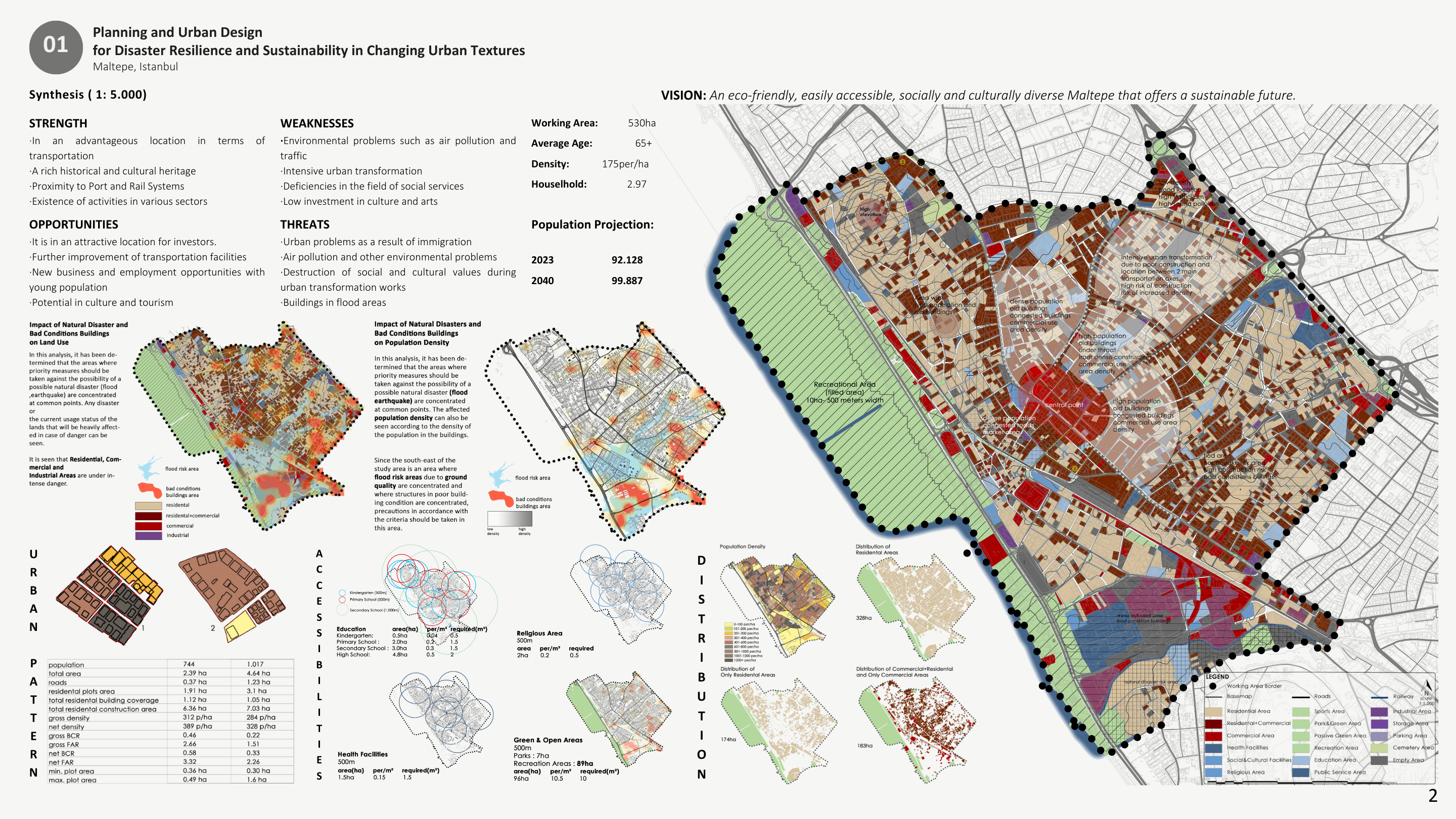
• Synthesis ( 1: 5.000 )
This synthesis integrates natural disaster risks, land use, population density, accessibility, and urban structure in Maltepe, Istanbul to define spatial priorities at a 1:5,000 scale. The outcome establishes a strategic framework that guides resilient urban design decisions aligned with sustainability and long-term development goals.
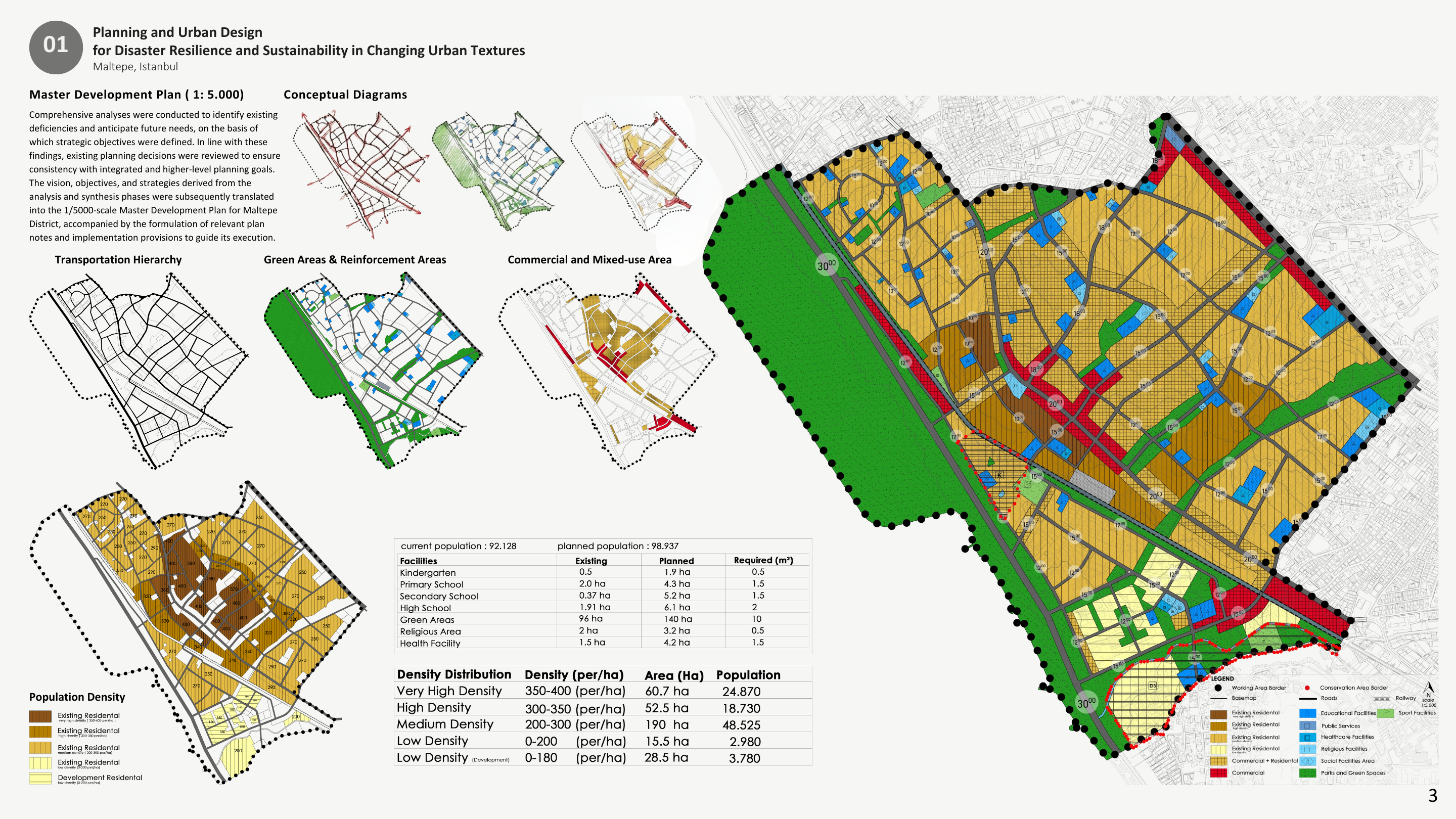
• Master Development Plan ( 1: 5.000 )
Based on comprehensive analyses and synthesis outcomes, this master plan translates strategic planning decisions into a coherent spatial framework for Maltepe at a 1:5,000 scale. The plan defines land-use structure, transportation hierarchy, green networks, and mixed-use areas to support resilient, accessible, and sustainable urban development.
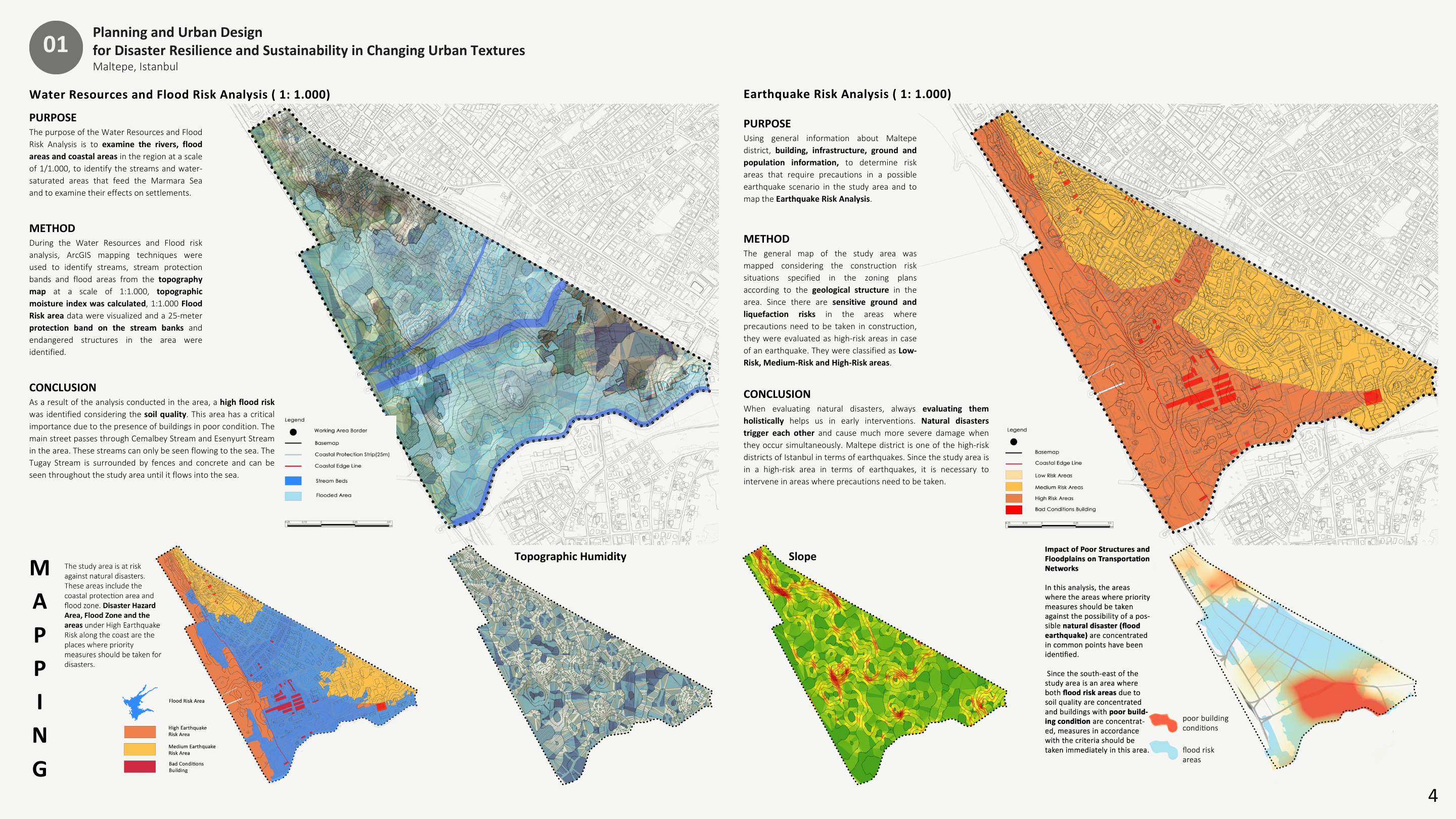
• Water Resources & Flood Risk Analysis - Earthquake Risk Analysis ( 1: 1.000 )
This detailed analysis examines flood and earthquake risks in Maltepe at a 1:1,000 scale by integrating topography, hydrology, soil conditions, building quality, and geological structure. The results identify micro-scale high-risk zones and emphasize the need for targeted, site-specific interventions to reduce disaster vulnerability.
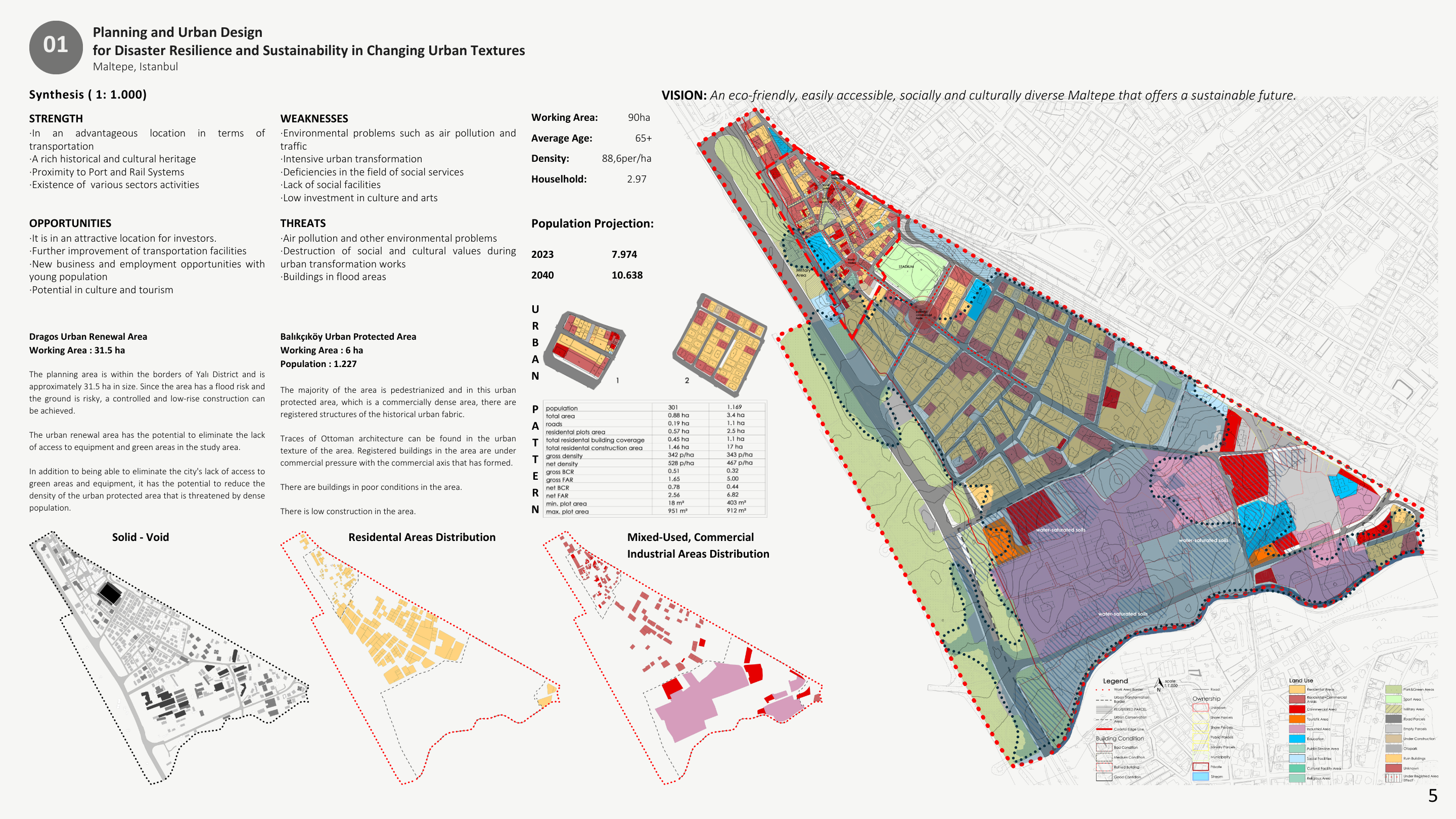
• Synthesis ( 1: 1.000 )
This synthesis consolidates micro-scale analyses of land use, population structure, building conditions, and risk factors to define spatial priorities at a 1:1,000 scale. The outcome supports site-specific urban renewal and protection strategies that align resilience, accessibility, and sustainable development goals.
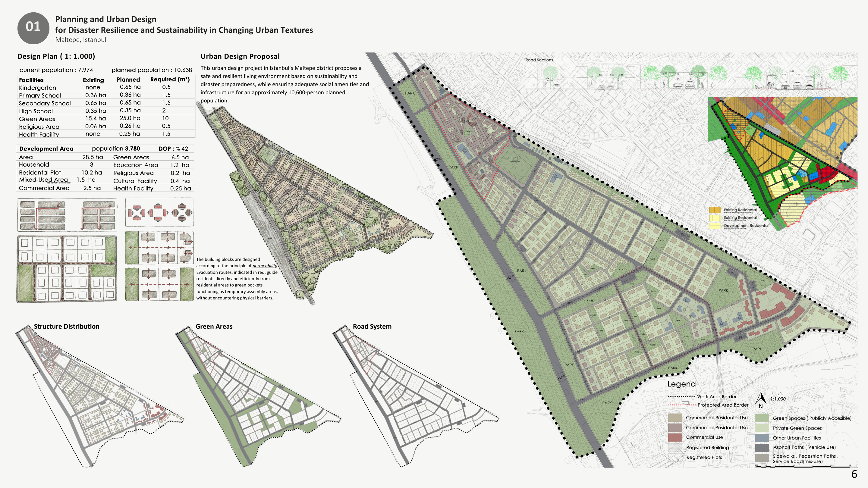
• Design Plan ( 1: 1.000 )
This design plan proposes a resilient urban layout for Maltepe at a 1:1,000 scale, integrating housing, social facilities, green networks, and a permeable street system. The proposal supports disaster preparedness, walkability, and quality public space while accommodating projected population growth in a sustainable manner.
• Design Plan ( 1: 500 ) and Axonometric View
This site-scale design plan develops a resilient and human-centered neighborhood layout at a 1:500 scale, prioritizing pedestrian movement, permeable ground surfaces, and accessible green spaces. Conceptual sketches, diagrams, and axonometric views translate disaster-aware planning principles into a coherent and livable urban environment.

Project developed by Erkan Karasaç.